Storing a set of different sized wrenches or other tools might require a tool roll that has varying length pockets. Here are two ways to achieve that.


Storing a set of different sized wrenches or other tools might require a tool roll that has varying length pockets. Here are two ways to achieve that.
I have not so much to do right now besides clean the house and ride my motorcycle, so I thought I should do some crafting!
This craft is a custom tool roll. Tool rolls are used by mechanics to store tools that are all used in one job – for example, two wrenches, a pair of pliers, an extension, and four screwdrivers. Sometimes, a full set of wrenches might be stored. However they are stuffed, they make life easy by not only providing a place to keep the tools safe and sound, but also to protect them and provide a soft work surface to lay them out on. Your tool-using buddies will love this, and probably ask for more of them. I use them for my motorcycles – first to replace the crappy plastic ones that come with the bikes, and second to make customized ones for trips where I want to take only a certain set of tools in the least amount of space possible. I’m thinking of making one for a GF to hold her knitting needles!
You need fabric, thread, and twill tape to make this craft. Use a heavy cotton twill or denim fabric. Cotton is great because it will hold some oil and this will keep the tools from rusting. Do not use bias or other types of tape, these will stretch or wear out much more quickly than twill.
Start with a rectangle of fabric. For a large tool roll, 24″x20″ is a good size. A smaller tool roll might start with 18″x12″ or even smaller. All sorts of sizes are possible and useful. A special tool roll with an angled bound edge or bottom edge is also used for certain wrench sets.
Fold a length of twill tape once and bind one of the short edges with it.
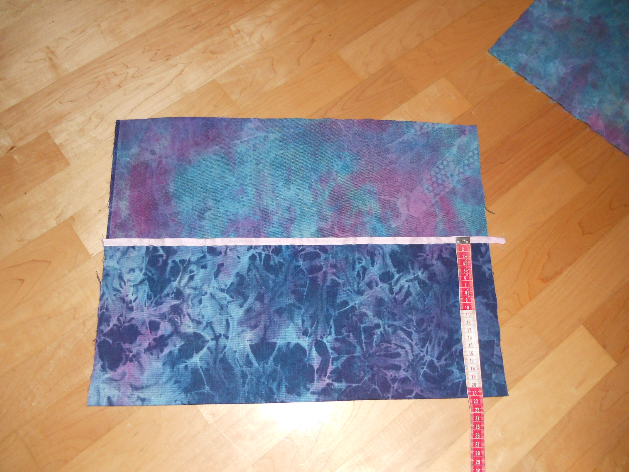
Fold up the bound edge about 1/3 of the way – if you have 24″ of fabrid, fold up a bit more than 8″. Mark off every 2″ and sew channels into the folded fabric from the bottom edge up to the bound edge. Place a bar tack at the bound edge end of each channel to support it. For smaller tool rolls, 1″ channels will work, too. Smaller than 1″ and nothing really fits. Baste the outside edges of the two end channels.

Next, fold and iron enough twill tape to stitch around the outside edge. Zigzag this on, paying attention to going around the corners. Fancier tool rolls will have rounded edges at the top.
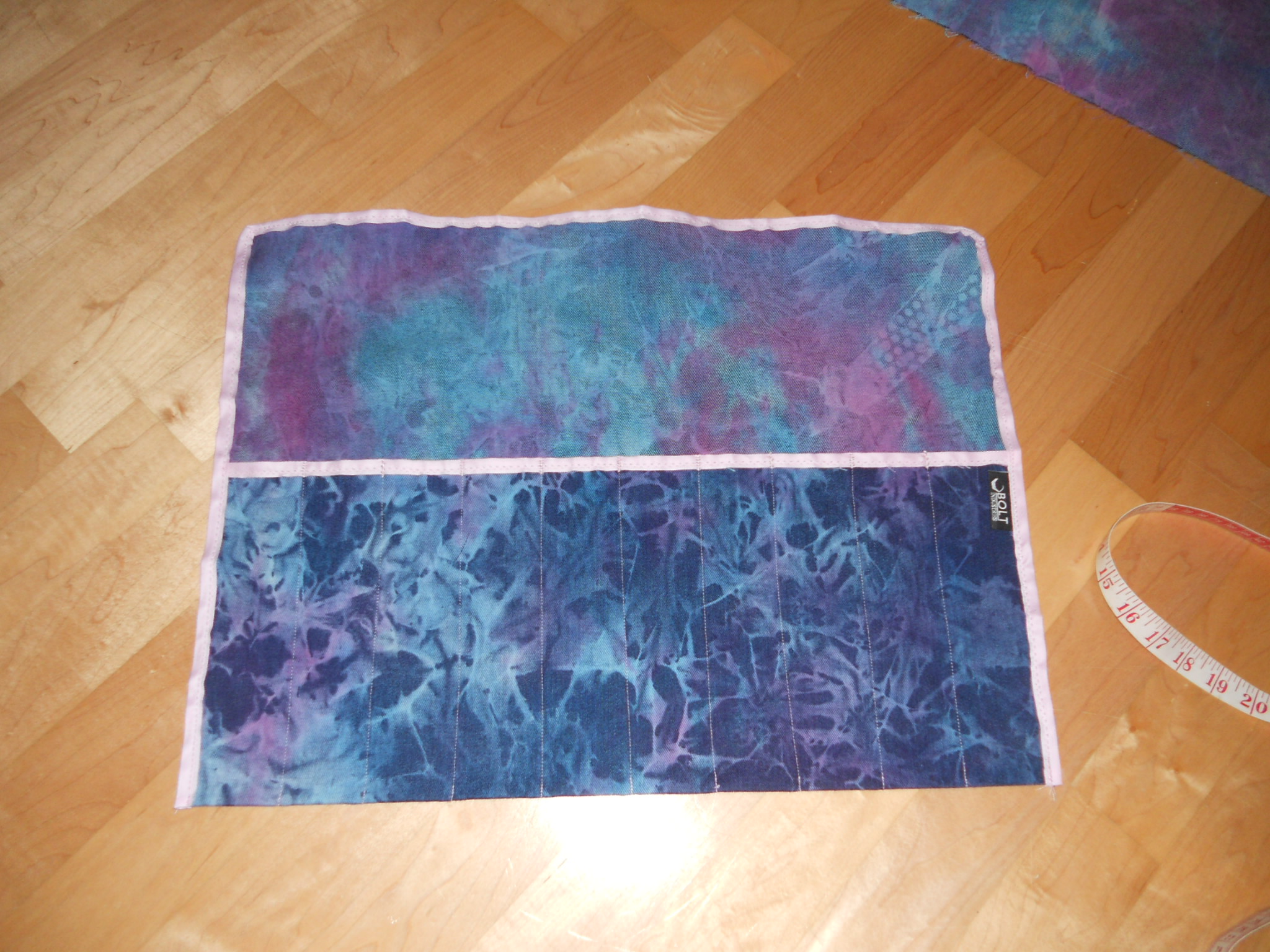
Cut a length of twill tape about 1.5x longer than the tool roll is wide, and bar tack this to the back side just below the bound edge.

Flip the tool roll over and fold down the top flap over the bound edge, then roll it up and tie it with the twill tape you’ve tacked to the back side. This is a completed tool roll.

If you have an embroidery machine, it would be very cool to enbroider their names on the outside of the flap.
1. Would do again. Over and over and over.
In the words of the guys from Grand Rapids “Get out! Go outside! Do something!” Check, check, and check. The goals of the trip were achieved and fun and adventure were had. This, as Gatsby says, is living! With hope, more adventure will ensue, even if it means renting bikes on one continent or another.
2. Pre-trip planning paid off huge.
We began serious planning four weeks out, prior to that, it was just “hey, let’s ride some passes” over coffee/tea/ice cream. We used two guidebooks and a found map of the Alps with passes marked. 100 Alpenpässe mit dem Motorrad and Pässe XXL. We are searching for a copy of the map, it was excellent, but now nearly destroyed. While the two books often differed in observations and ratings of the various passes, we were able to get a general idea of what to expect. We began by assembling the list of interesting passes and then plotting them on the map. From this, we assembled a route that would touch them with minimal transit time. I used both Google Maps and BaseCamp to visualize the routes, settling on BaseCamp as planning proceeded. Prior to departure, an overview map was created using GPSvisualizer.com.
The general idea for the trip was to focus exclusively on ascents and descents while minimizing transits. This is how the AutoZug got slotted in – it shaved an entire day of transit from the trip. We spent roughly ten hours discussing and plotting the route on the map (four significant revisions) and I put another ten+ hours into BaseCamp. There were two significant versions of the .gpx fileset prior to departure. Two changes to the fileset were made underway, most noteably the transit of Julier in place of Albuela. The Landeck loop was not set in the proper direction as loaded and needed to be reversed in the unit. The final version of the route as ridden is available by email request. Too late, we discovered that Garmin speaks more characters than TomTom, which would not load files with non-base-ASCII characters in the names (umlauts!). Once the umlauts were removed (after the trip), the files loaded without problem. How American.
We established through internet and social contacts that 200 to 300kms per day was realistic, this assisted with route planning and expectations. We were in this range or exceeding it all days, at the expense of photos on the higher mileage days (end of trip). The non-pass (effectively transit) stages were not as well documented as the pass stages.
We checked with assorted sources to look into hotels and found that we could expect to find places without stress along the route. This proved to be quite true, and with the exception of Switzerland, we found the prices quite acceptable. We estimated 100€ per day for all expenses and this was sufficient without having to worry about money. In retrospect, we would stay at more pass hotels, as this almost guarantees a traffic-free trip up at the end of the day and a traffic-free trip down in the morning. Travelling without fixed hotel plans opened up many options for distance planning and allowed us to flow with the ride each day. This is a very good thing.
3. Should include human aspects in the pre-trip planning.
Pair an introvert with an extrovert and eventually there will be friction. We mediated this by choosing single rooms when available. We were able to handle it in stride for the most part, but would recommend that people have this discussion up front. It can save some stress on the road.
4. Gear planning is critical.
Considerable back and forth about leather versus textile occupied the three weeks prior to the trip. Textile won out and happily so. Washable underlayers were the winners. Socks need to be upgraded. You can not unpack and repack enough times. All Dainese boots leak eventually. The Vario boxes from BMW are much tougher than people make them out to be. They don’t break, they collapse, which means a few clicks and they are back to normal.
5. The bike was awesome.
Whatever worries I had about the bike are not there any more. What a super performer, even with the engine having a whopping 600kms on it prior to going out. I could have packed fewer tools, but was quite concerned about issues. NONE. Not a one. Big thumpers are in their element on steep descents. The compression braking is formidable. I could run whole descents in second gear and need no brakes. Amazing. The single item is a possibly worn-through chain guard, which is being supplemented by a piece of plastic binder right now. If the noise comes back, I’ll know what to replace. No surprise as I was running slack on top due to the engine braking.
6. Postbusses
I would be remiss in not mentioning the Postbusses. In most of Austria and some of Italy, the public transit is run by the post office. They have to deliver the mail anyway, so why not deliver a few people while they are at it? To a one, these are some of the most professional, courteous, and skilled large vehicle operators I have ever encountered. Where tourist busses were clogging traffic and taking up space, the Postbus drivers were following the road and holding impressive lines. Riders should take note that there is nothing to fear from a Postbus. Everything else? Be afraid. Be very afraid.
1. Sudelfeldstraße/Tatzelwurm
2. Pass Thurn
3. Grossglocknerhochalpenstraße – Fuscher Törl
4. Grossglocknerhochalpenstraße – Hochtor
5. Kreuzbergpass
6. Passo San Antonio
7. Passo Tre Croci
8. Passo di Falzarego
9. Passo Fedaia
10. Passo Sella
11. Grödner Joch (Passo de Gardena)
12. Passo Campolongo
13. Passo Pordoi
14. Passo Sella (again!)
15. Mendelpass
16. Gampenjoch
17. Ofenpass (Passo del Fuorn)
18. Flüela Pass
19. Julierpass
20. Berninapass
21. Forcola de Livigno
22. Passo D’Eira
23. Passo di Foscagno
24. Stilfserjoch (Passo dello Stelvio)
25. Umbrail Pass
26. Reschenpass
27. Silvarettahochalpenstraße Bielerhöhe
28. Brandnertal
29. Flexenpass
30. Arlberg Pass
31. Kühtai Sattel
32. Holzleitensattel
33. Fernpass
34. Engpass
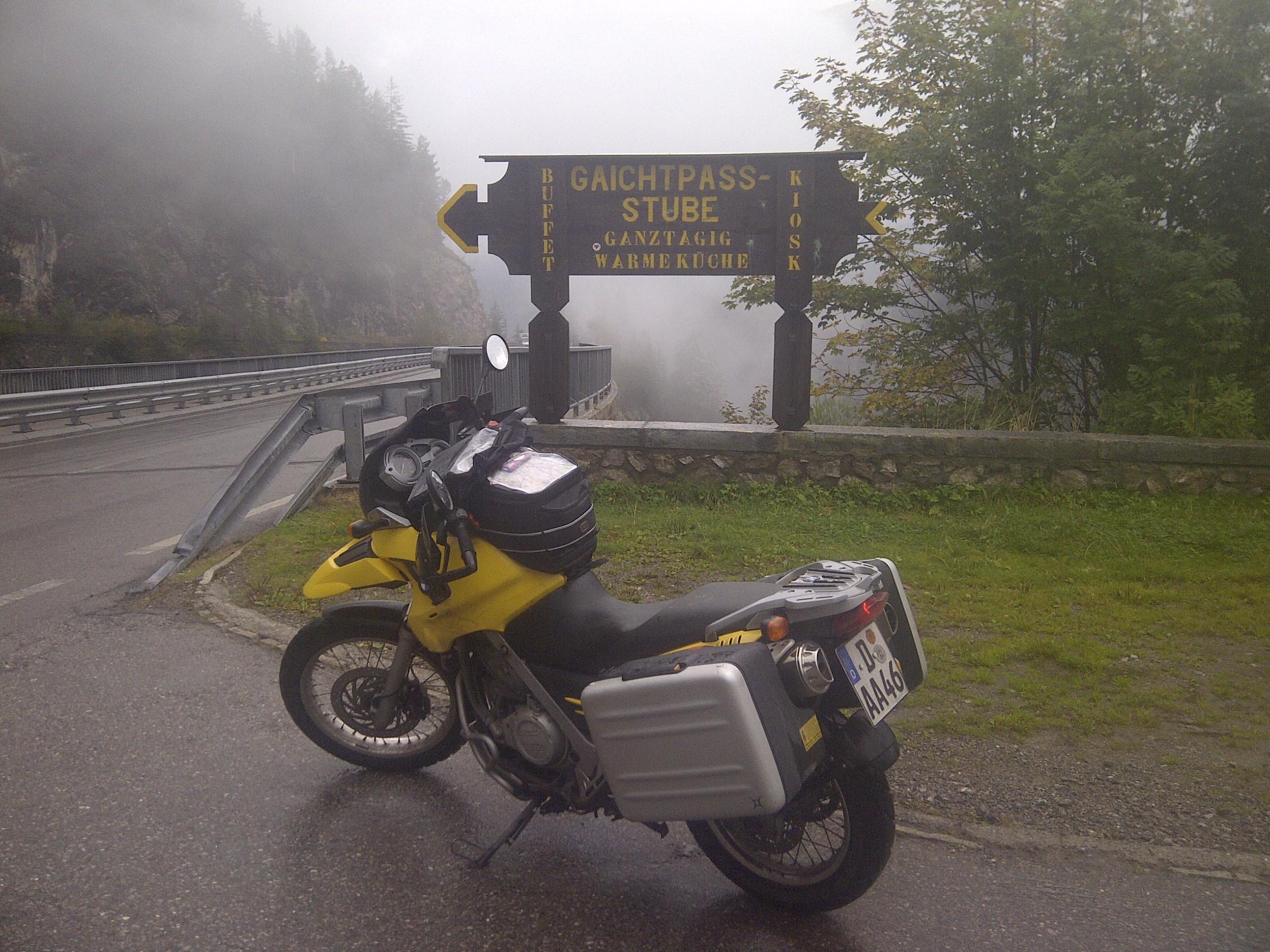
35. Gaichtjoch
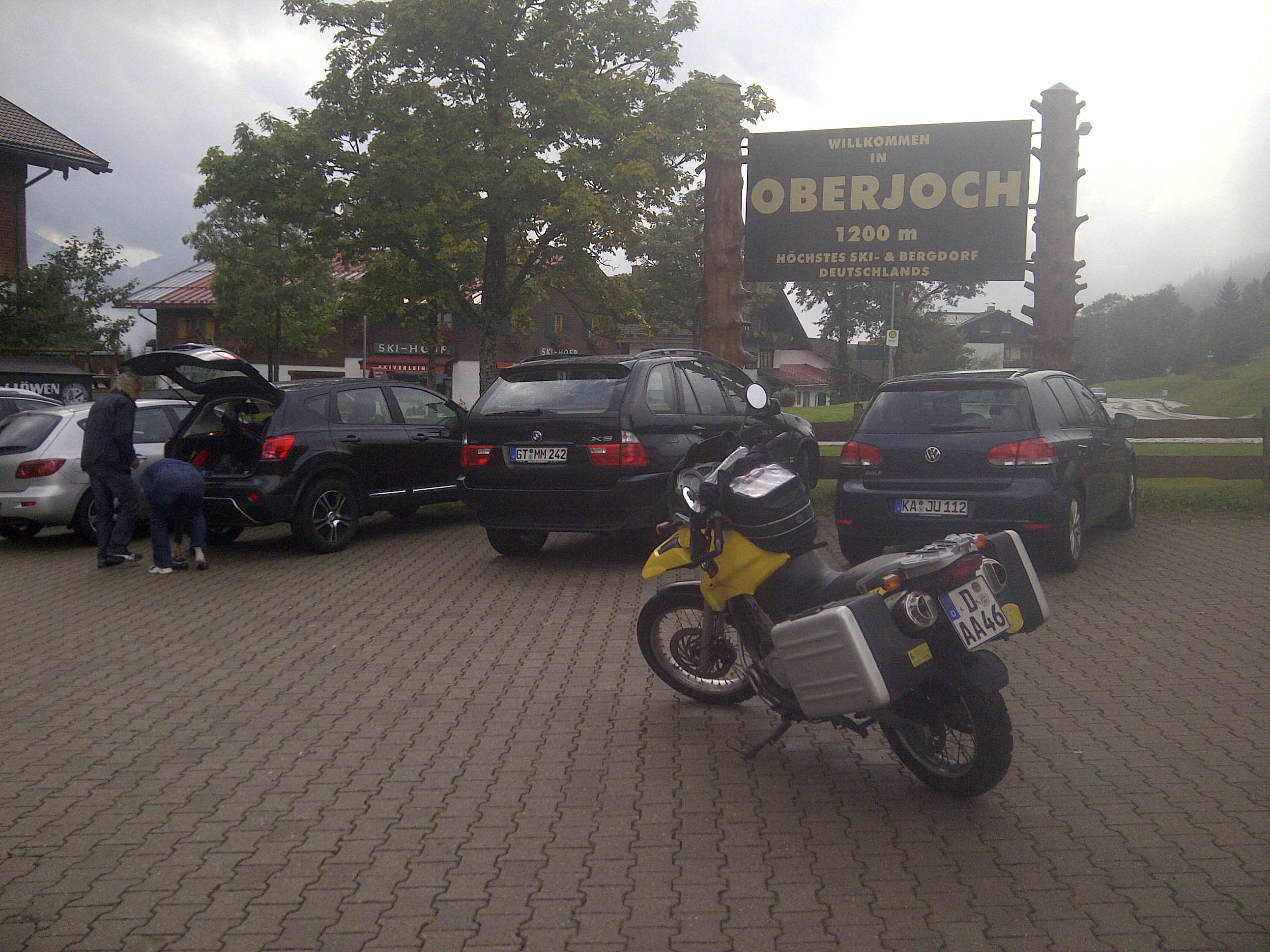
36. Oberjoch
The Almabtrieb, as it happens.
We leave the Alter Posthof after a solid breakfast and head north on the B327 to pick up the A61 at exit 41. Yesterday’s transit stage has worn us out a bit, but we are looking forward to some fun in the Eifel, the driving and riding playground of Germany’s Rheinland-Pfalz, and home to the famous Nürburgring. I’ve planned a 75km loop north of there that I’ve stolen from the Eifeldiplom Classic route – the upper section of the popular day tour.
We detour from the straight route to the start of the loop on the to grab some extra curves, exiting on the B412 and riding to Kempenich where we pick up the L83 and L85. A favorite farm road of mine is now closed to traffic, and we have to continue north to Bad Neuenahr on L84. We see many wine festivals and pilgrimages on the way, but are focused on the home stretch, so no stopping for pictures. It’s the Eifel, we’ve seen it a hundred times before anyway. We backtrack from Bad Neuenahr on the B257, follwing signs for the Nürburgring until we get to Dümpelfeld. We turn onto the L73 and follow it to our destination, the Haus Waldfrieden, a popular biker stop with a large parking area, hot tea, and good food. After a quick snack, we head back out. Photos from prior visits.


The loop begins on the L73 and picks up the L74. That is, the real L74. I identify a bug in my Garmin nüvi – it wants to cut the route short by cutting subloops off. We backtrack and get going in the right direction. The ride cards would have been easier here, but I do not have them along. We turn off on the K11, following it to the K13, and turing north on the L165. Turning off on the K55, we pick up the L165 again in Esch, where we tank up – I remembered a fuel station, but expected it earlier. We add 267.2kms to the clock, for a total of 24. . A short distance on Römerstrasse lands us on the K50 which turns into the K25. A right turn puts us back onto the L73. In Schuld, we turn onto the K16 to begin the third and final subloop.
The final stretch includes several Kehren descending into Fuchshofen on the K17. We take the L73 back to Haus Waldfrieden and relax with lunch prior to heading home.
Going home is getting to the Autobahn: we retrace our steps on the L73 and B257 to the A61 north, A1 north, A57 north, and A46 east. This brings us into the city of Düsseldorf, where we hit the Rheintunnel and then pick up the B8 back to the house. The final count on the odometer is 159,7km, for a total of 2573,7km. Somehow, the trip odometer readings and the main odometer readings are off on both bikes, we assume some BMW magic is at work here. The final main odometer talley is 2599km on my bike. We strip and clean the bikes in the drive, and take a look at the stickers collected. After that, it is time to eat dinner and sleep, work calls in the morning.
Adventure complete. At least, for now.
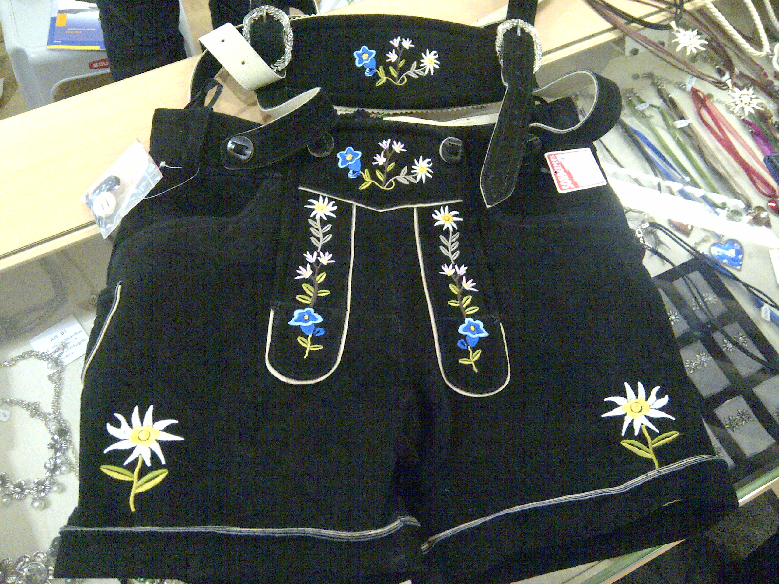
We fish the bikes out of the carport they are in, but dawdle in Sontfhofen to shop. We’ve found a trachtenmode shop and it opens at 0930. As we are in the heart of Tirol and close to Bayern, it seems we should be able to get some deals. I score with some short black ladies’ Lederhosen with edelweiss embroidery and a pink dirndle. My riding partner picks up a new leather wallet. I have my goods shipped and we head out.

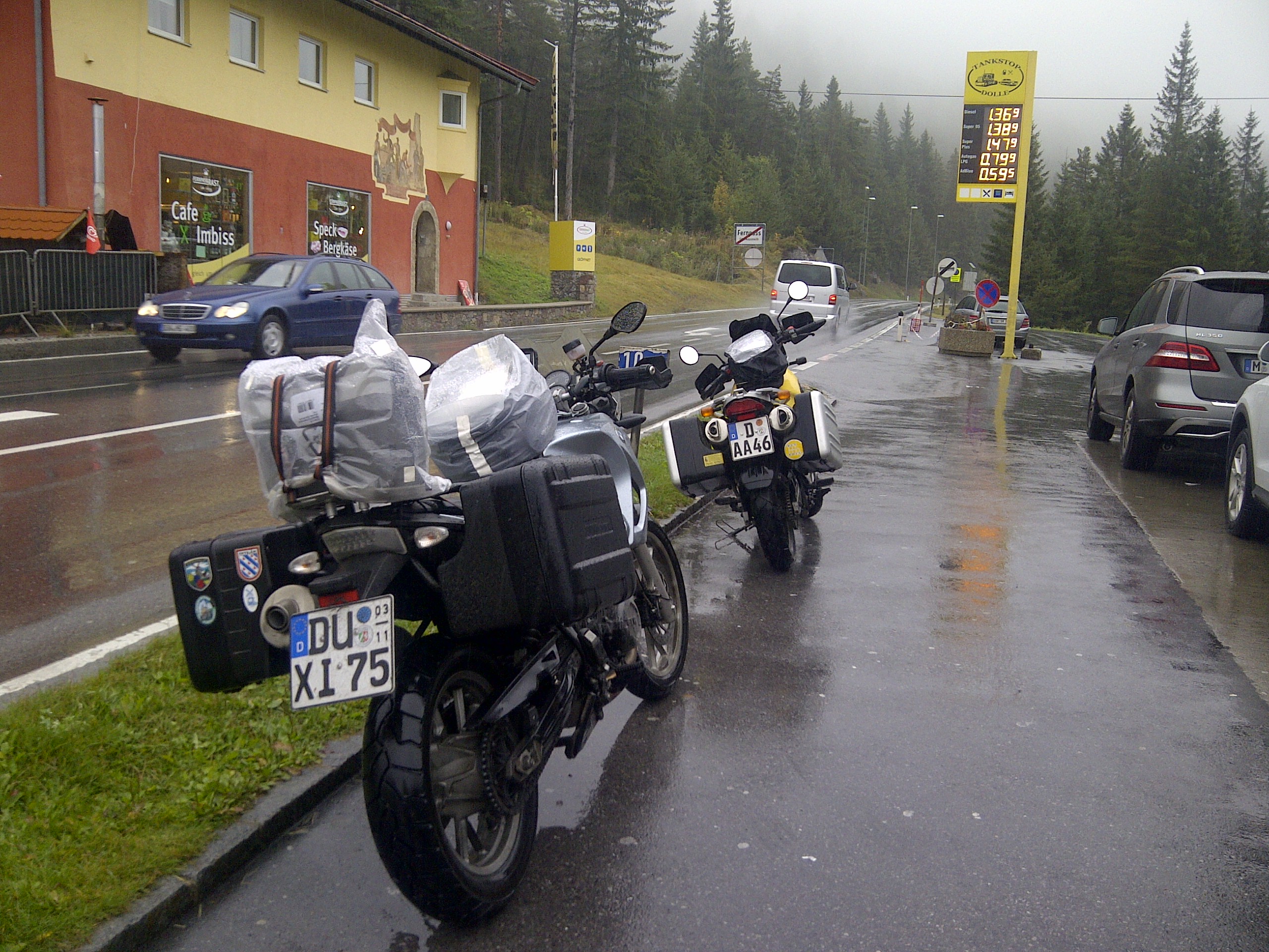
First stop is fuel. This adds 289.8kms for a total of 1799.0. Much to our dismay, a valve stem on my riding partner’s bike disintegrates as she checks her tyre pressure. Quite a bit of phone calling ensues, along with a wait. In the absence of rain, this is not so bad. Eventually, it’s Euromasters to the rescue. They pick up the bike with their TireTruck – with a full wheel shop inside – and we head over to the workshop where it is a bit easier to work on bike tyres. The tech and I banter about the superiority of shaft drive while he works. He has a new stem in and the wheel balanced very quickly, and at 1300 we are finally on the road.

We head north on the B19 and join the A7 north to points Stuttgart. It’s a day of a lot of distance, and not much real excitement. We’ve finished the passes in unexpectedly short time, completing all of our “long” loops and extensions aside from the closed Faschinajoch and the inaccessible-due-to-said-closure Hochtannenberg Pass. Having previously discussed the possibility of some Eifel riding, we head north and west, picking up the A8 east,the A5 north, and the A61 north. The A61 is the backbone of the Rheinland and is the scenic alternative to the east A3 route. We stop for fuel at Dannstadt, tacking 347.8kms on, for a total of 2146,8kms so far.
Exiting the A61 at 43, we take the L215 and L214 to the B327, which we follow while looking for a place to stay. We land in Ehr, slightly south of Boppard, at the Landgasthaus Alter Post. We are directed to the guest house across the street with the instructions that it can be used as a double room or two singles as we see fit, all for 35€ per person. It’s lovely, and we are very happy with the quiet. The bikes are stowed in a private parking area near a large barn, and we unpack. Dinner in the main house is very pleasant with a nice wine and spirits selection. We recommend Alter Post if you are travelling and want to get off the main road. You won’t be disappointed.


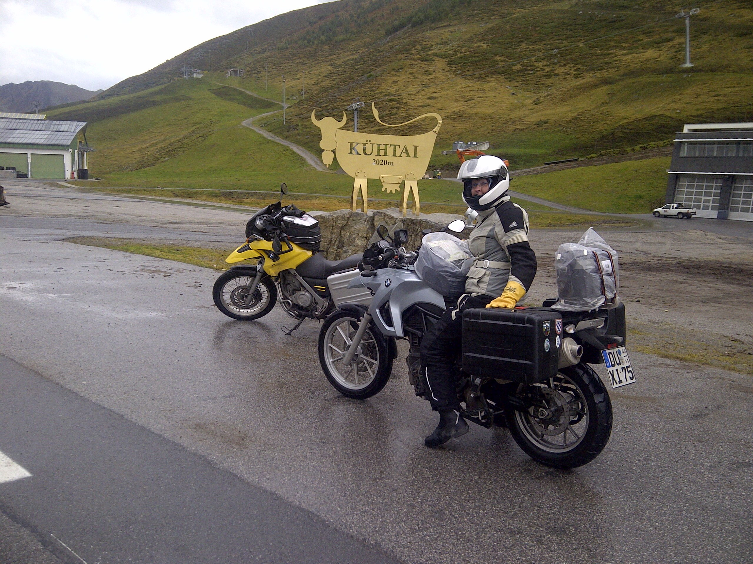
It’s raining again as we pack up and leave the Wilder Mann. I find a Golf plastered with the worst of America’s VW scene offerings – impolite stickers. I want to scrape the rear window, but there are passes to ride…. We head back to the same Shell station and this adds 293.1kms, for a total of 1509.2km traveled. Retracing our steps to Landeck, this time we head north and pick up the 171 through Imst. We turn off onto the 186 to Öztal and then onto the L237, the route over the Kühtaisattel.

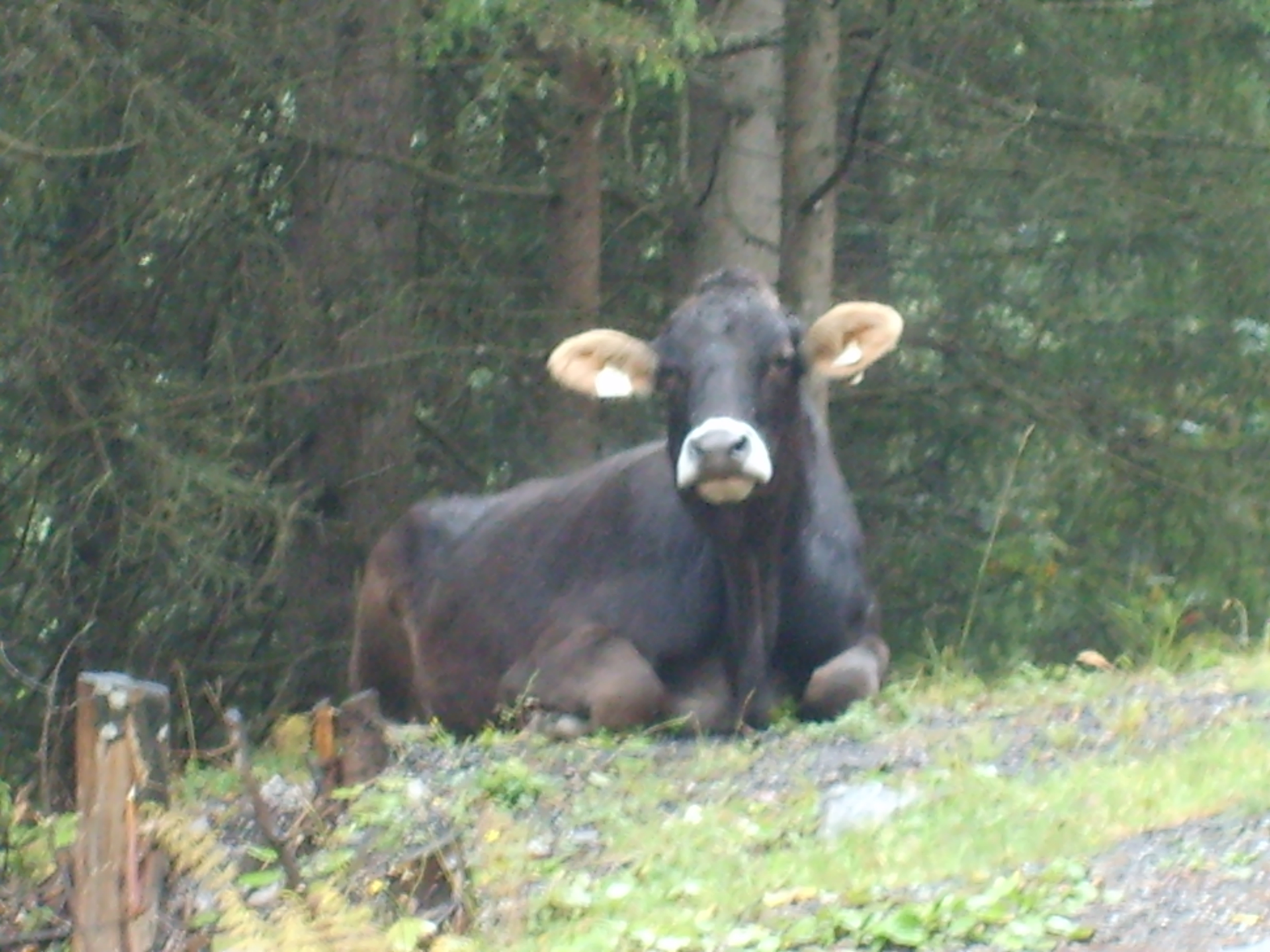
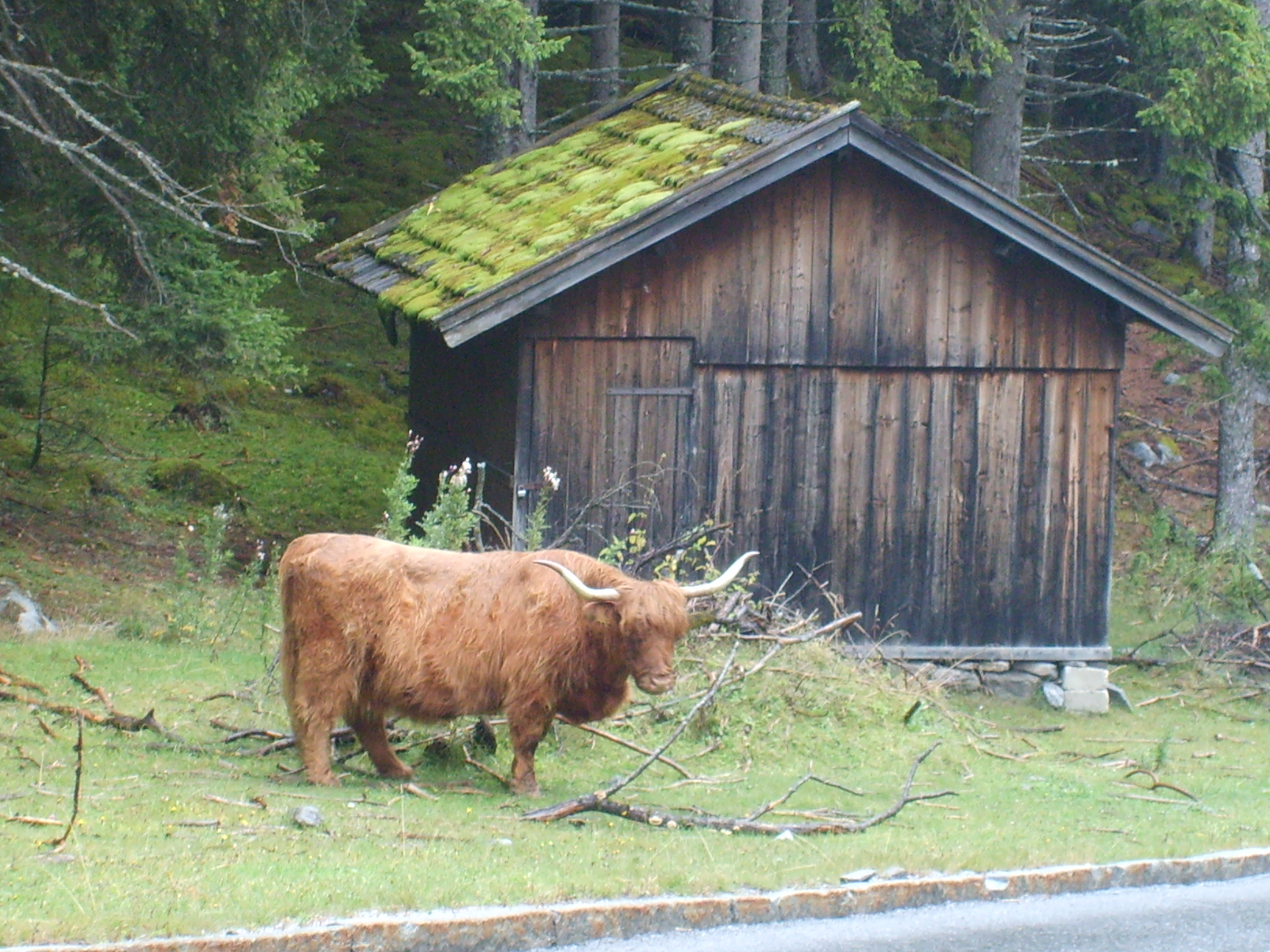
The ascent does not disappoint at all. Küh is German for cow. There are… more cows. When we arrive at the top, the sun peeks through for a few precious moments. Clearly a ski resort only town, Kühtai is mostly closed. We are able to get stickers and postcards, but find nowhere to warm up or grab a hot tea. On the way down, we spy a longhorn, watching us patiently. The descent along the L13 includes a 1.2km stretch of 16% grade, the steepest we have seen in Austria.


We connect to the 171 with the L11. From the 171, we pick up the 189 and cross the Holzleitensattel. Then, onto the 179, steadily proceeding northwest. Traffic increases, but not significantly at first.
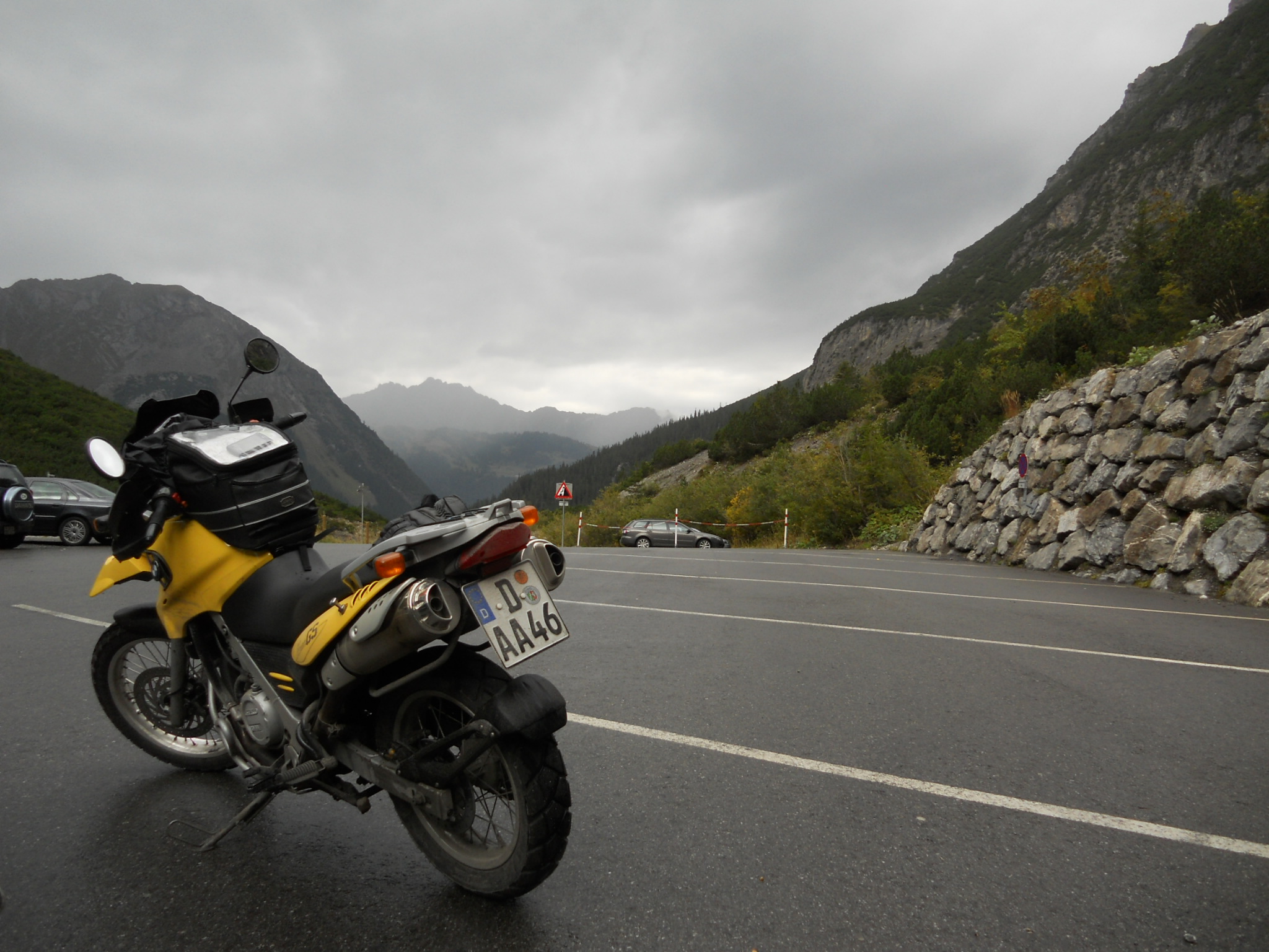
The Fernpass nearly does us in. Packed with holiday and commercial traffic, it is slow and miserable. The rain is increasing steadily and we are getting very wet. My experience with GoreTex leads to a few tricks that keep me somewhat drier than my partner, but either way, we stop at top of the Fernpass to warm up and eat up.
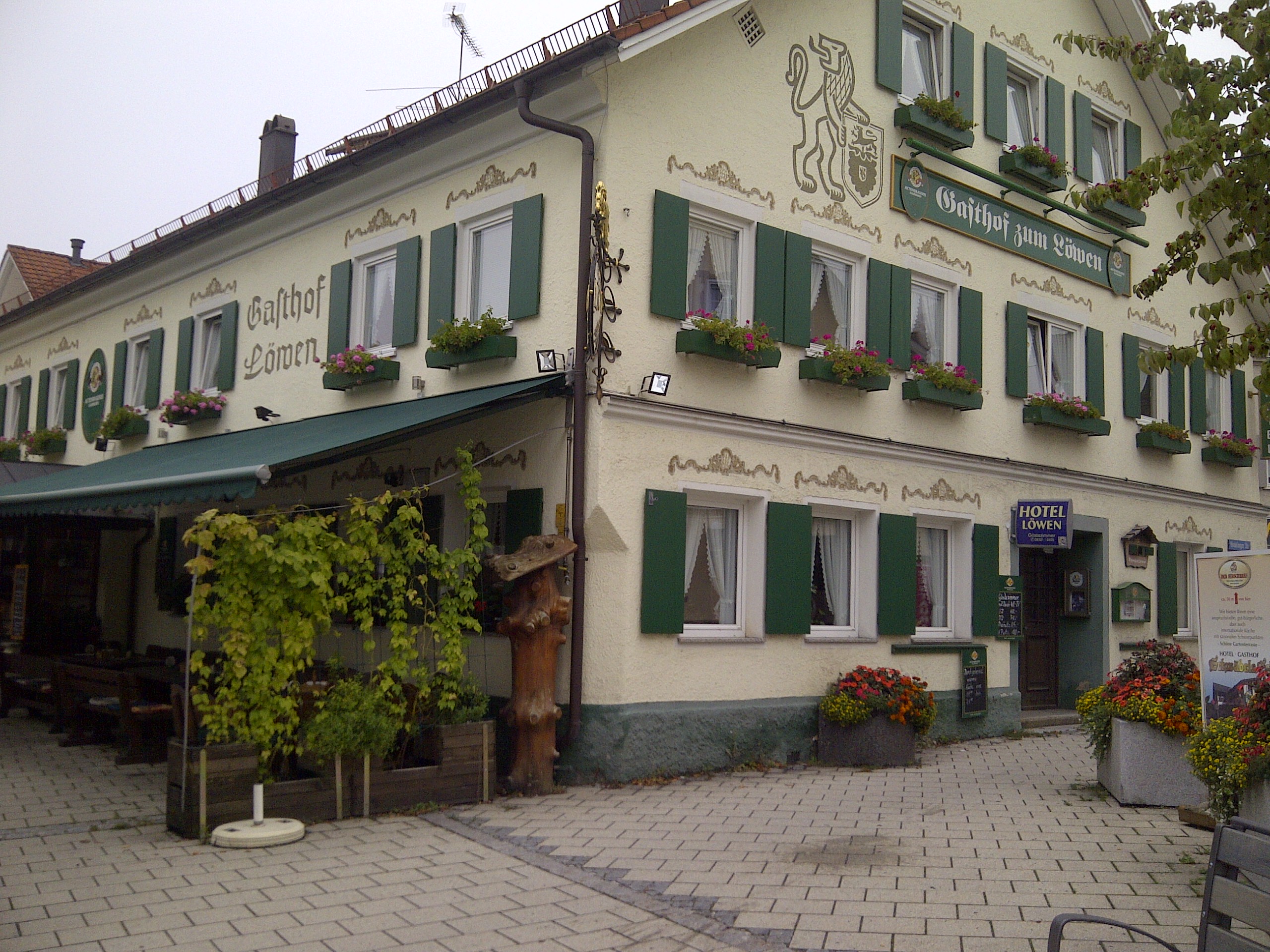
After a bit of rest, we soldier on through the heavy rain. I leave about fifteen minutes before my partner as I am starting to get stiff and want to avoid a repeat of Stelvio. The avalanche galleries in Lermoos offer some respite, and on exiting, even a bit of sun. I pick up the 198 in Reutte and the 199 in Weißenbach. There are no markers for the Engpass, and the Gaichtpass has only a sign for the nearby bar. I do find one of the many warning signs to remind riders to slow down – this one says “give your guardian angel a chance”. The 199 becomes the B308 in Germany and leads to Oberjoch. At Oberjoch, the pass is drawfed by the ski town nearby. After a mixup sending me up the B310 and A7 to Kempten, we meet as planned in Sonthofen and find refuge at the Gasthof zum Löwen.

Breakfast at the Gasthof Wilder Mann is the deciding factor, we choose to leave our side cases and return later in the evening for a second night. This day’s ride is the first of two “escape” loops planned into the trip to allow us to expand or contract the distance as needed. The ride begins with an airy sense of lightness – with no luggage, the bikes are each about 25kg lighter. We stop for fuel a few kms north in Prutz, adding 229,8kms for a total of 1216,1km. We continue north on 180 to L76, and pick up 171 in Landeck. Following the advice of the two guidebooks we have read, we turn south on 188 toward the Silvaretta Hochalpenstraße.
The ascent includes an 11€ toll for motorcyclists. The long, winding approach to the pass is easy, with a view of moss-covered rockfaces and small streams. At the top of the Silvaretta is a large retention lake, the Bielerhöhe, and the Piz Buin hotel. Piz Buin is a well-known European sunscreen brand, but we find no sun. We are deep into the first of two very rainy days that will challenge our gear more than ourselves.

Coming down the west side of the Silvaretta Hochalpenstraße, we find tree trimmers. The road is littered with tree branches and leaves, making the riding more interesting on this side. The scenery is a mix of deciduous trees and pines, with nearly all of the road edges forested. We agree that aside from the trees, the descent was far more fun and interesting than the ascent.
From Silvaretta, we follow the 188 to Bludenz and find the L82 that will take us to the Brandertal. The Brandertal is a dead end ascent that ends at the Lunarsee gondola lift. The ascent is technical and fun, until we encounter a cattle transporter that nearly forces us off the road. We keep our eyes up and ride it out, with 10cm of road to the right and maybe 20cm of space to the left. This becomes the new discussion topic. We stop at the top to admire the mountain and scratch around in the dirt. Shout out to the ADV crowd! On the way down, we stop at the Schattenlagenhütte for a light lunch. Conveniently, they have a lovely ceramic stove that serves as a helmet and glove dryer.


We return to Bludenz without encountering any more cattle transporters, and find the 913, as we hope to make our way to the Faschinajoch and …. Unfortunately, we find a sign indicating closure of the road from Blons to Sonntag, which means we will have to skip these two passes. We are disappointed, but not completely, the weather is cold and unforgiving, so we return to Bludenz to pick up the shortened version of the loop.
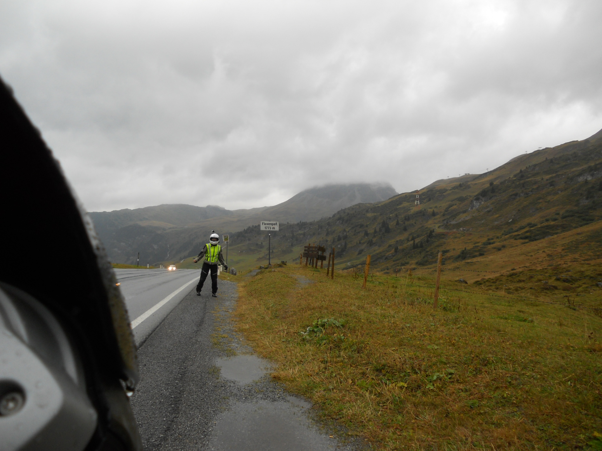
Following the L97, we proceed east. My partner chooses to return to the Wilder Mann, and has an adventure with the Autobahn. We have not purchased vignettes – the small toll stickers required in every country other than Germany – and have carefully planned to avoid all Autobahns. The only quick way back to the Gasthof is the Autobahn, and she sweet-talks her way out of the toll plaza at the end of the (very warm) Arlberg Tunnel and avoids the fine and vignette cost. I proceed on the L97 after my own Autobahn detour due to construction and pick up the 197, turning north on the 198 to Lech in pursuit of the Flexenpass. The ride up is beautiful even in the rain, with long rock-hewn avalanche galleries that are being renovated. Traffic delays of up to fifteen minutes are expected, but no more than five minutes for me. I ride into the gallery with a group of Swiss riders while we wait for the Touran behind us to flash us forward. Returning from the pass, I wait no more than a few minutes to descend through the tunnels again. I regain the 197 and stop at the Arlberg Passhohe to collect stickers and postcards.

We rejoin at the Wilder Mann for a second delicious dinner and sleep away the cold rain of the day.